| diagram | 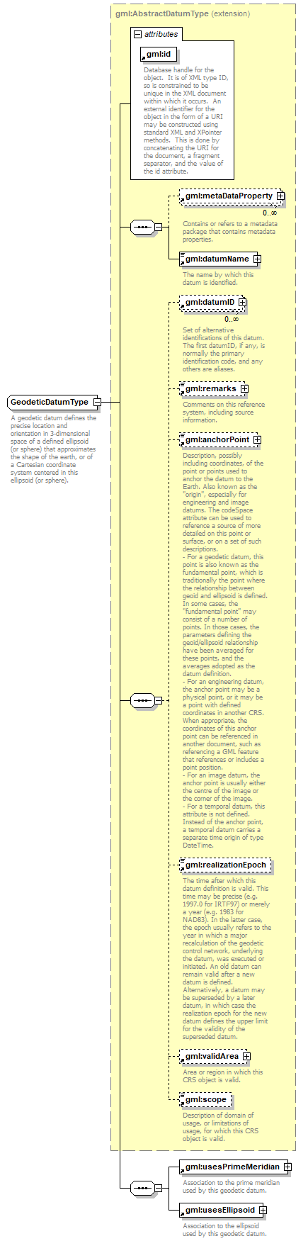 |
||||||||||||||
| namespace | http://www.opengis.net/gml | ||||||||||||||
| type | extension of gml:AbstractDatumType | ||||||||||||||
| properties |
|
||||||||||||||
| children | gml:metaDataProperty gml:datumName gml:datumID gml:remarks gml:anchorPoint gml:realizationEpoch gml:validArea gml:scope gml:usesPrimeMeridian gml:usesEllipsoid | ||||||||||||||
| used by |
|
||||||||||||||
| attributes |
|
||||||||||||||
| annotation |
|
||||||||||||||
| source | <xs:complexType name="GeodeticDatumType"> <xs:annotation> <xs:documentation>A geodetic datum defines the precise location and orientation in 3-dimensional space of a defined ellipsoid (or sphere) that approximates the shape of the earth, or of a Cartesian coordinate system centered in this ellipsoid (or sphere). </xs:documentation> </xs:annotation> <xs:complexContent> <xs:extension base="gml:AbstractDatumType"> <xs:sequence> <xs:element ref="gml:usesPrimeMeridian"/> <xs:element ref="gml:usesEllipsoid"/> </xs:sequence> </xs:extension> </xs:complexContent> </xs:complexType> |
XML Schema documentation generated by XMLSpy Schema Editor http://www.altova.com/xmlspy