See ISO/DIS 19136 13.3.The spatial-temporal coordinate reference systems schema components are divided into two logical parts. One part defines elements and types for XML encoding of abstract coordinate reference systems definitions. The larger part defines specialized constructs for XML encoding of definitions of the multiple concrete types of spatial-temporal coordinate reference systems.These schema components encode the Coordinate Reference System packages of the UML Models of ISO 19111 Clause 8 and ISO/DIS 19136 D.3.10, with the exception of the abstract "SC_CRS" class.GML is an OGC Standard.Copyright (c) 2007, 2010, 2016, 2018 Open Geospatial Consortium.To obtain additional rights of use, visit http://www.opengeospatial.org/legal/ .
Properties
attribute form default
unqualified
element form default
qualified
version
3.2.2
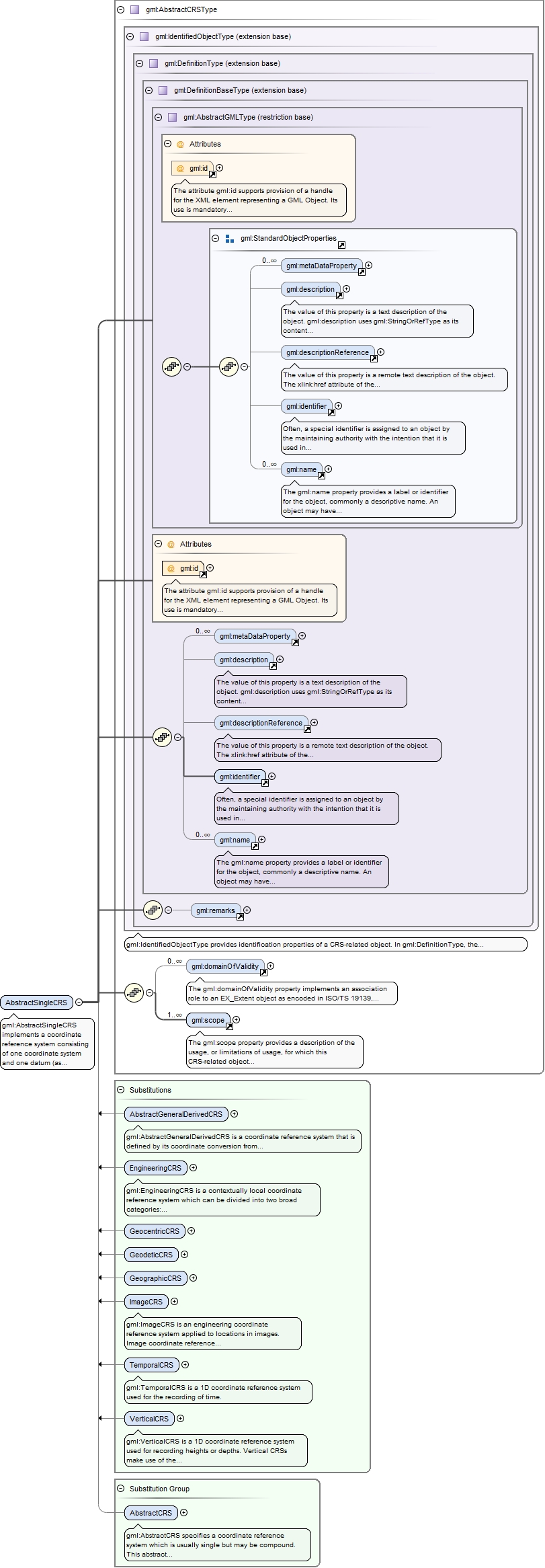
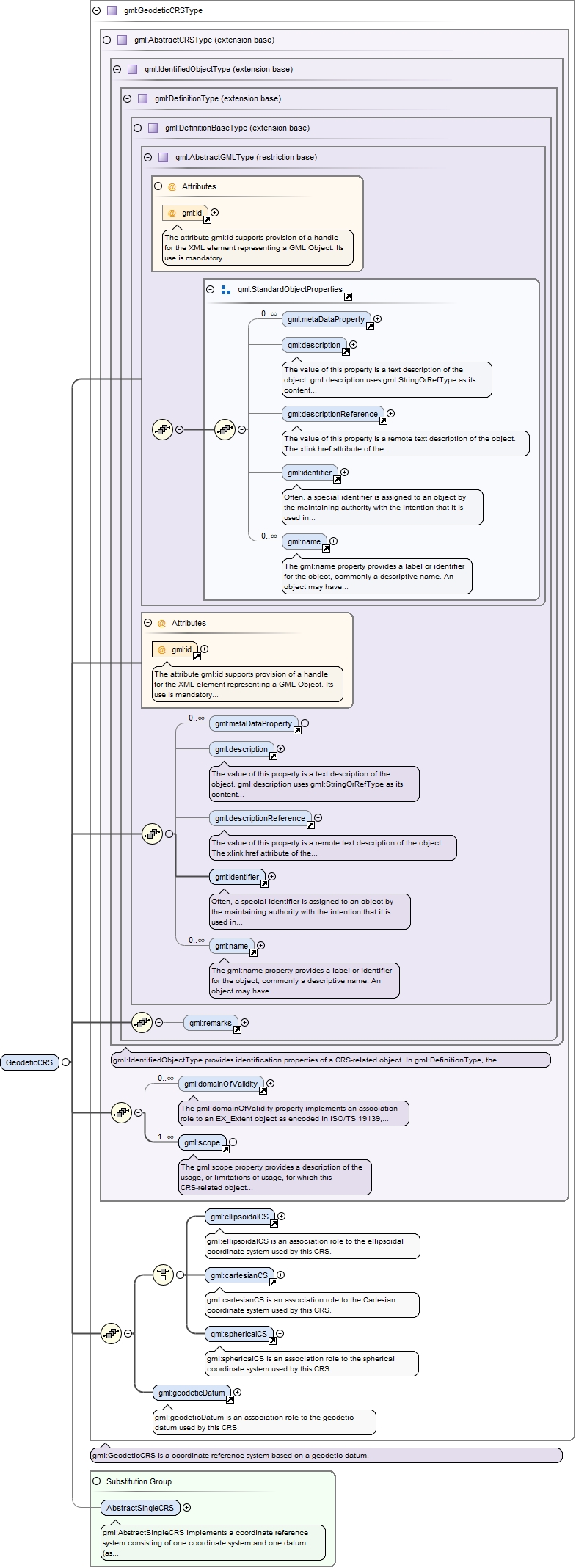
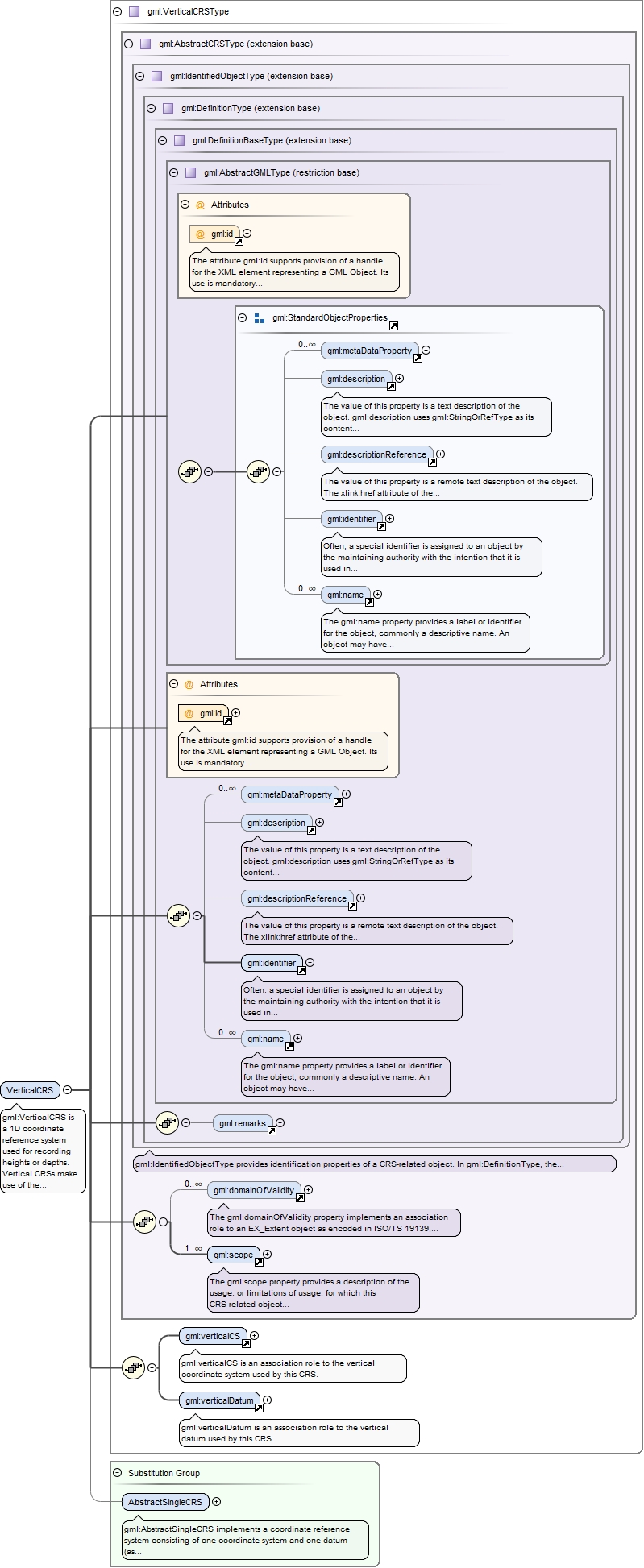
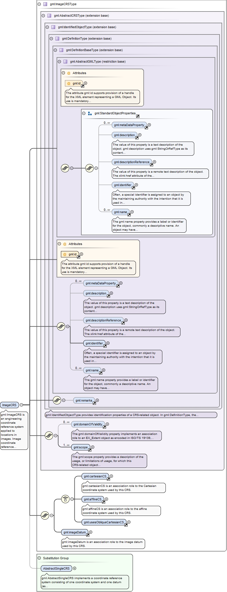
Element gml:AbstractSingleCRS
Namespace
http://www.opengis.net/gml/3.2
Annotations
gml:AbstractSingleCRS implements a coordinate reference system consisting of one coordinate system and one datum (as opposed to a Compound CRS).
The attribute gml:id supports provision of a handle for the XML element representing a GML Object. Its use is mandatory for all GML objects. It is of XML type ID, so is constrained to be unique in the XML document within which it occurs.
Source
<element name="AbstractSingleCRS" type="gml:AbstractCRSType" abstract="true" substitutionGroup="gml:AbstractCRS"><annotation><documentation>gml:AbstractSingleCRS implements a coordinate reference system consisting of one coordinate system and one datum (as opposed to a Compound CRS).</documentation></annotation></element>
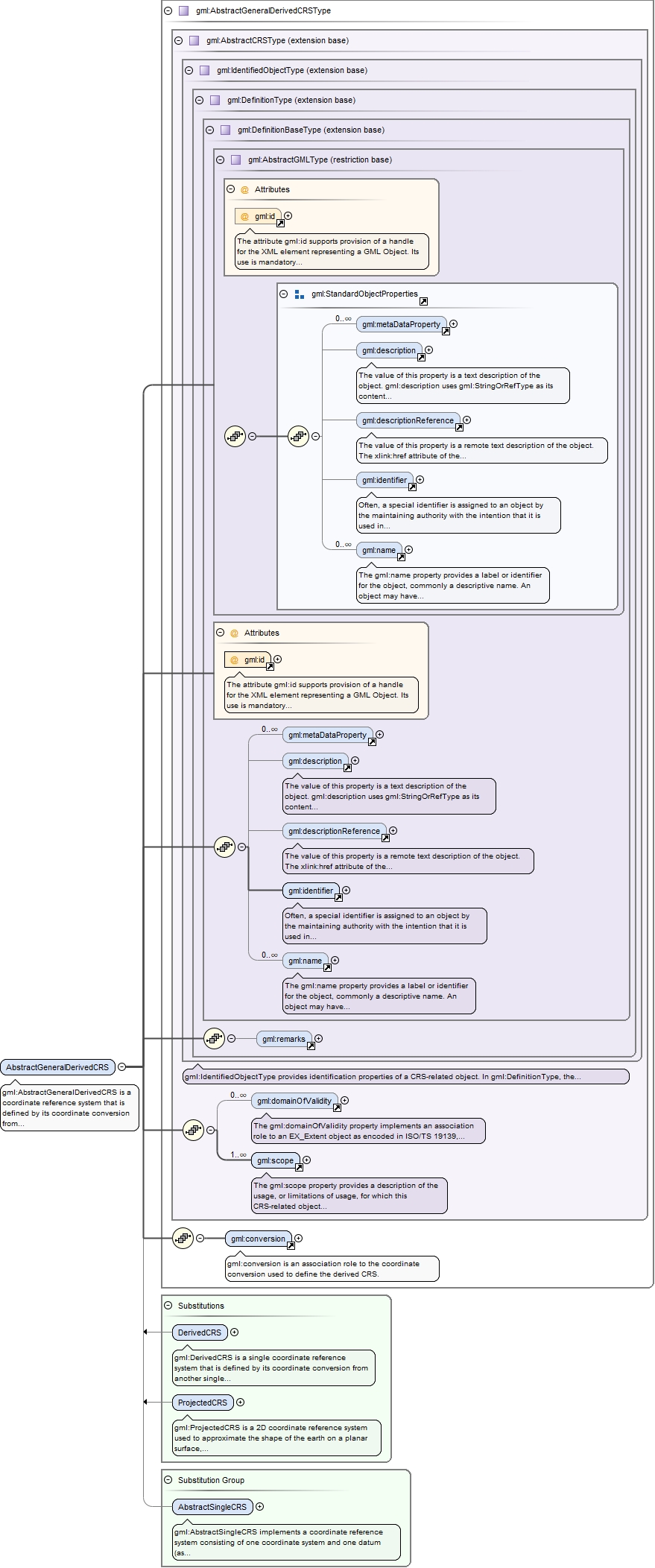
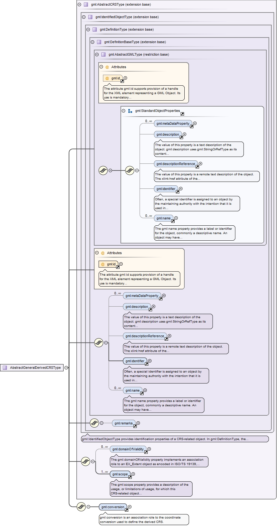
Element gml:AbstractGeneralDerivedCRS
Namespace
http://www.opengis.net/gml/3.2
Annotations
gml:AbstractGeneralDerivedCRS is a coordinate reference system that is defined by its coordinate conversion from another coordinate reference system. This abstract complex type shall not be used, extended, or restricted, in a GML Application Schema, to define a concrete subtype with a meaning equivalent to a concrete subtype specified in this document.
The attribute gml:id supports provision of a handle for the XML element representing a GML Object. Its use is mandatory for all GML objects. It is of XML type ID, so is constrained to be unique in the XML document within which it occurs.
Source
<element name="AbstractGeneralDerivedCRS" type="gml:AbstractGeneralDerivedCRSType" abstract="true" substitutionGroup="gml:AbstractSingleCRS"><annotation><documentation>gml:AbstractGeneralDerivedCRS is a coordinate reference system that is defined by its coordinate conversion from another coordinate reference system. This abstract complex type shall not be used, extended, or restricted, in a GML Application Schema, to define a concrete subtype with a meaning equivalent to a concrete subtype specified in this document.</documentation></annotation></element>
Element gml:conversion
Namespace
http://www.opengis.net/gml/3.2
Annotations
gml:conversion is an association role to the coordinate conversion used to define the derived CRS.
<element name="conversion" type="gml:GeneralConversionPropertyType"><annotation><documentation>gml:conversion is an association role to the coordinate conversion used to define the derived CRS.</documentation></annotation></element>
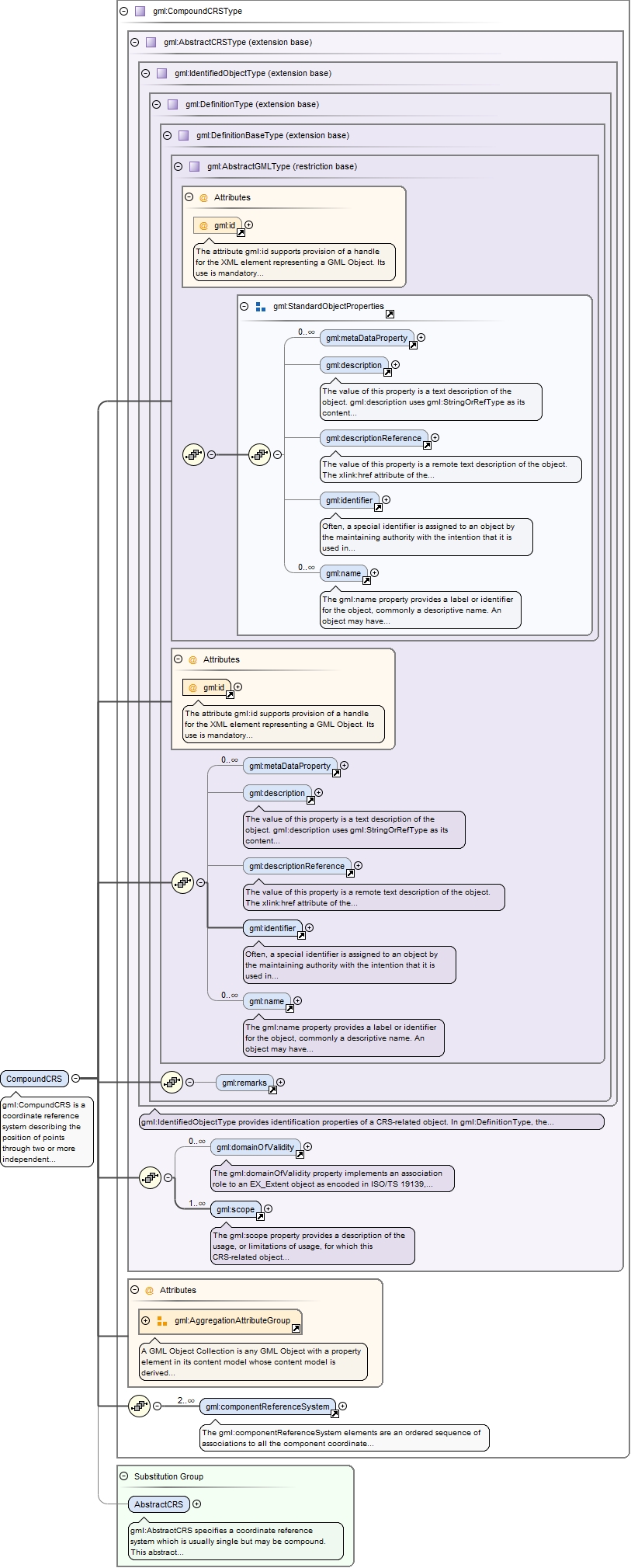
Element gml:CompoundCRS
Namespace
http://www.opengis.net/gml/3.2
Annotations
gml:CompundCRS is a coordinate reference system describing the position of points through two or more independent coordinate reference systems. It is associated with a non-repeating sequence of two or more instances of SingleCRS.
The attribute gml:id supports provision of a handle for the XML element representing a GML Object. Its use is mandatory for all GML objects. It is of XML type ID, so is constrained to be unique in the XML document within which it occurs.
Source
<element name="CompoundCRS" type="gml:CompoundCRSType" substitutionGroup="gml:AbstractCRS"><annotation><documentation>gml:CompundCRS is a coordinate reference system describing the position of points through two or more independent coordinate reference systems. It is associated with a non-repeating sequence of two or more instances of SingleCRS.</documentation></annotation></element>
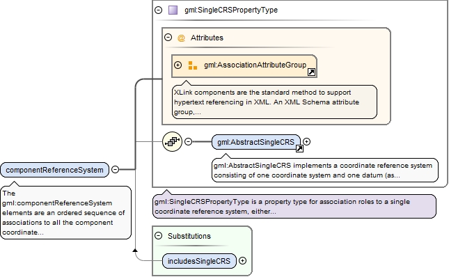
Element gml:componentReferenceSystem
Namespace
http://www.opengis.net/gml/3.2
Annotations
The gml:componentReferenceSystem elements are an ordered sequence of associations to all the component coordinate reference systems included in this compound coordinate reference system. The gml:AggregationAttributeGroup should be used to specify that the gml:componentReferenceSystem properties are ordered.
<element name="componentReferenceSystem" type="gml:SingleCRSPropertyType"><annotation><documentation>The gml:componentReferenceSystem elements are an ordered sequence of associations to all the component coordinate reference systems included in this compound coordinate reference system. The gml:AggregationAttributeGroup should be used to specify that the gml:componentReferenceSystem properties are ordered.</documentation></annotation></element>
The attribute gml:id supports provision of a handle for the XML element representing a GML Object. Its use is mandatory for all GML objects. It is of XML type ID, so is constrained to be unique in the XML document within which it occurs.
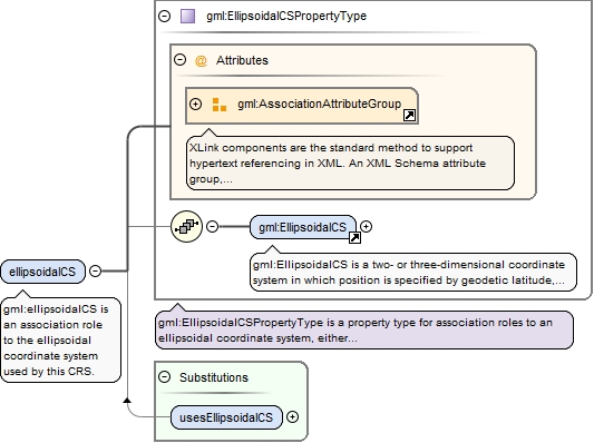
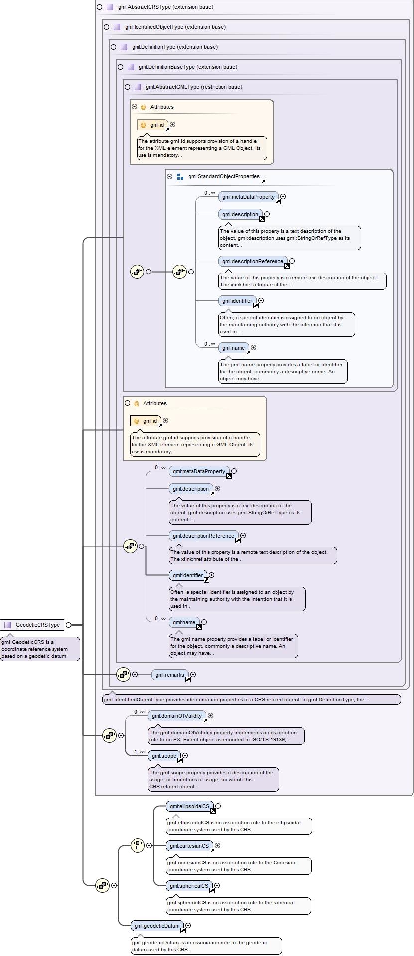
<element name="ellipsoidalCS" type="gml:EllipsoidalCSPropertyType"><annotation><documentation>gml:ellipsoidalCS is an association role to the ellipsoidal coordinate system used by this CRS.</documentation></annotation></element>
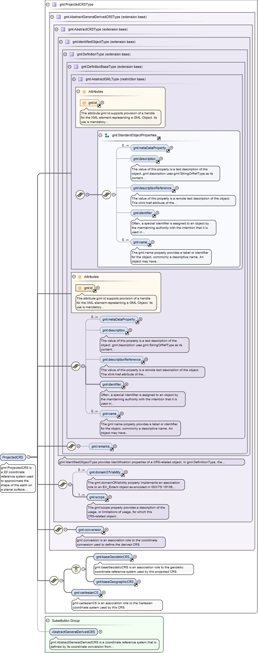
Element gml:cartesianCS
Namespace
http://www.opengis.net/gml/3.2
Annotations
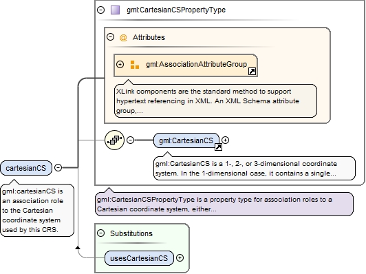
gml:cartesianCS is an association role to the Cartesian coordinate system used by this CRS.
<element name="cartesianCS" type="gml:CartesianCSPropertyType"><annotation><documentation>gml:cartesianCS is an association role to the Cartesian coordinate system used by this CRS.</documentation></annotation></element>
Element gml:sphericalCS
Namespace
http://www.opengis.net/gml/3.2
Annotations
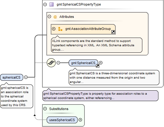
gml:sphericalCS is an association role to the spherical coordinate system used by this CRS.
<element name="sphericalCS" type="gml:SphericalCSPropertyType"><annotation><documentation>gml:sphericalCS is an association role to the spherical coordinate system used by this CRS.</documentation></annotation></element>
Element gml:geodeticDatum
Namespace
http://www.opengis.net/gml/3.2
Annotations
gml:geodeticDatum is an association role to the geodetic datum used by this CRS.
<element name="geodeticDatum" type="gml:GeodeticDatumPropertyType"><annotation><documentation>gml:geodeticDatum is an association role to the geodetic datum used by this CRS.</documentation></annotation></element>
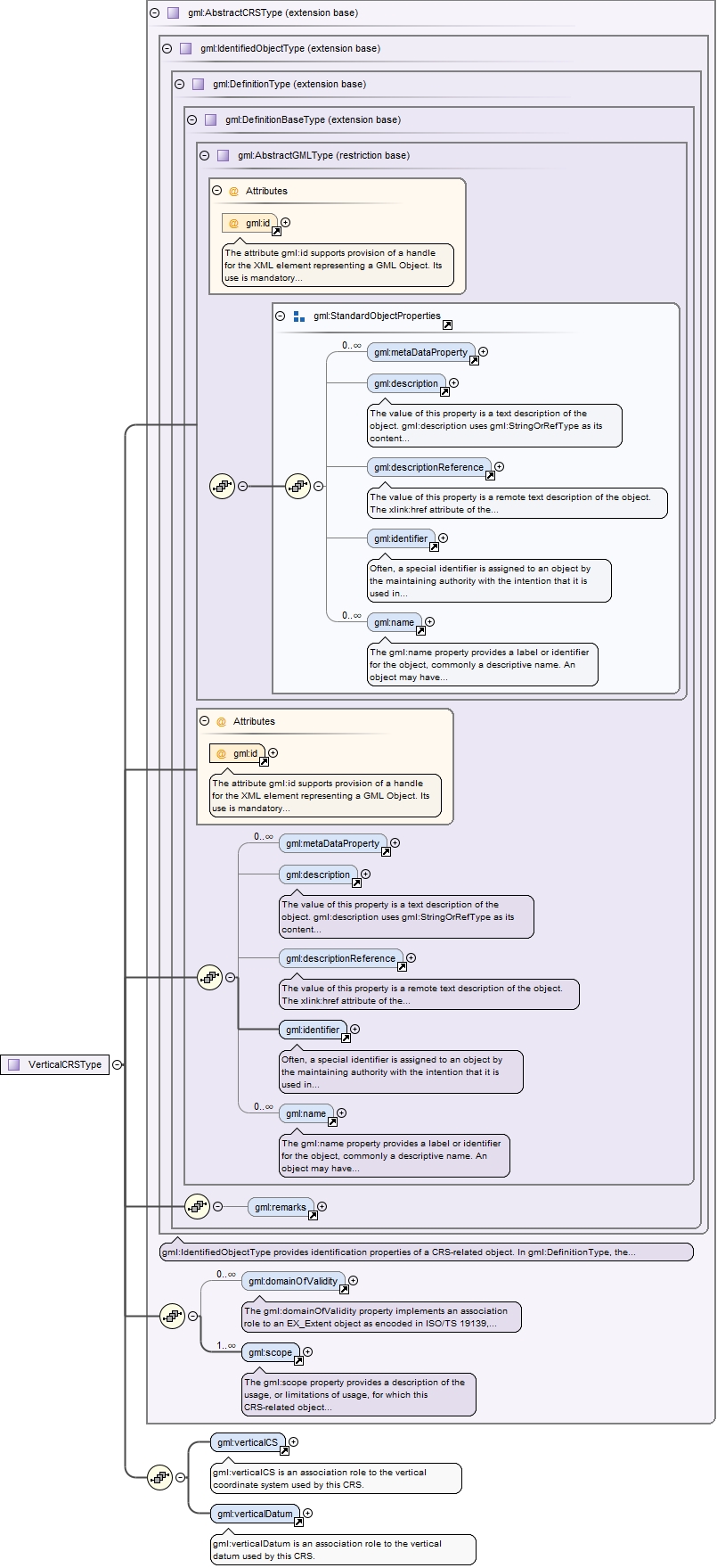
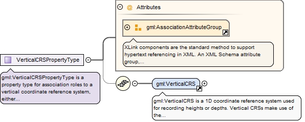
Element gml:VerticalCRS
Namespace
http://www.opengis.net/gml/3.2
Annotations
gml:VerticalCRS is a 1D coordinate reference system used for recording heights or depths. Vertical CRSs make use of the direction of gravity to define the concept of height or depth, but the relationship with gravity may not be straightforward. By implication, ellipsoidal heights (h) cannot be captured in a vertical coordinate reference system. Ellipsoidal heights cannot exist independently, but only as an inseparable part of a 3D coordinate tuple defined in a geographic 3D coordinate reference system.
The attribute gml:id supports provision of a handle for the XML element representing a GML Object. Its use is mandatory for all GML objects. It is of XML type ID, so is constrained to be unique in the XML document within which it occurs.
Source
<element name="VerticalCRS" type="gml:VerticalCRSType" substitutionGroup="gml:AbstractSingleCRS"><annotation><documentation>gml:VerticalCRS is a 1D coordinate reference system used for recording heights or depths. Vertical CRSs make use of the direction of gravity to define the concept of height or depth, but the relationship with gravity may not be straightforward. By implication, ellipsoidal heights (h) cannot be captured in a vertical coordinate reference system. Ellipsoidal heights cannot exist independently, but only as an inseparable part of a 3D coordinate tuple defined in a geographic 3D coordinate reference system.</documentation></annotation></element>
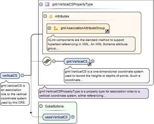
Element gml:verticalCS
Namespace
http://www.opengis.net/gml/3.2
Annotations
gml:verticalCS is an association role to the vertical coordinate system used by this CRS.
<element name="verticalCS" type="gml:VerticalCSPropertyType"><annotation><documentation>gml:verticalCS is an association role to the vertical coordinate system used by this CRS.</documentation></annotation></element>
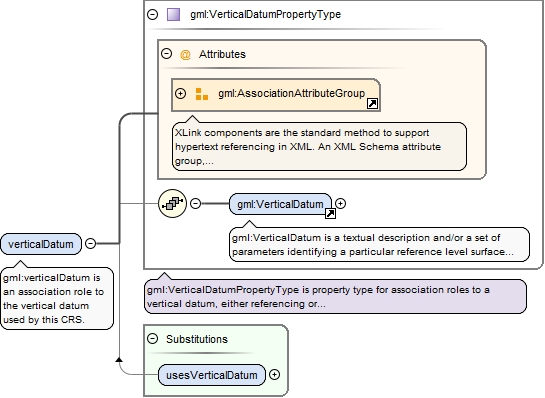
Element gml:verticalDatum
Namespace
http://www.opengis.net/gml/3.2
Annotations
gml:verticalDatum is an association role to the vertical datum used by this CRS.
<element name="verticalDatum" type="gml:VerticalDatumPropertyType"><annotation><documentation>gml:verticalDatum is an association role to the vertical datum used by this CRS.</documentation></annotation></element>
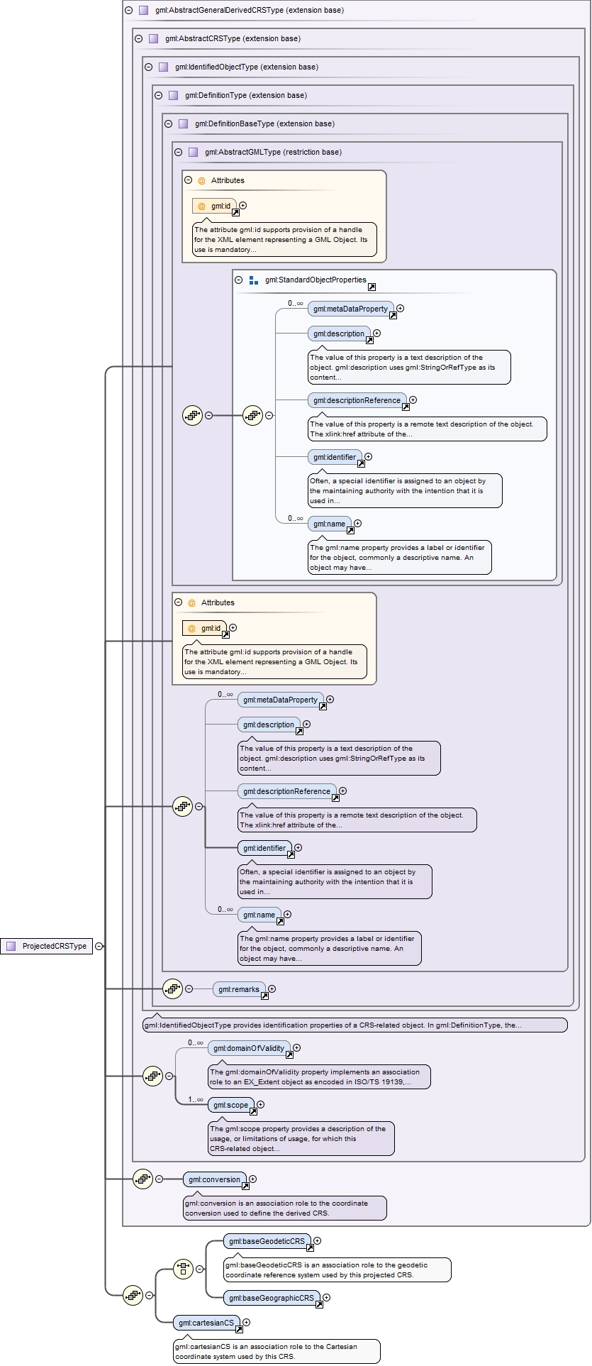
Element gml:ProjectedCRS
Namespace
http://www.opengis.net/gml/3.2
Annotations
gml:ProjectedCRS is a 2D coordinate reference system used to approximate the shape of the earth on a planar surface, but in such a way that the distortion that is inherent to the approximation is carefully controlled and known. Distortion correction is commonly applied to calculated bearings and distances to produce values that are a close match to actual field values.
The attribute gml:id supports provision of a handle for the XML element representing a GML Object. Its use is mandatory for all GML objects. It is of XML type ID, so is constrained to be unique in the XML document within which it occurs.
Source
<element name="ProjectedCRS" type="gml:ProjectedCRSType" substitutionGroup="gml:AbstractGeneralDerivedCRS"><annotation><documentation>gml:ProjectedCRS is a 2D coordinate reference system used to approximate the shape of the earth on a planar surface, but in such a way that the distortion that is inherent to the approximation is carefully controlled and known. Distortion correction is commonly applied to calculated bearings and distances to produce values that are a close match to actual field values.</documentation></annotation></element>
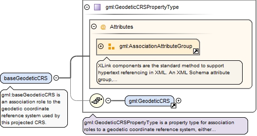
Element gml:baseGeodeticCRS
Namespace
http://www.opengis.net/gml/3.2
Annotations
gml:baseGeodeticCRS is an association role to the geodetic coordinate reference system used by this projected CRS.
<element name="baseGeodeticCRS" type="gml:GeodeticCRSPropertyType"><annotation><documentation>gml:baseGeodeticCRS is an association role to the geodetic coordinate reference system used by this projected CRS.</documentation></annotation></element>
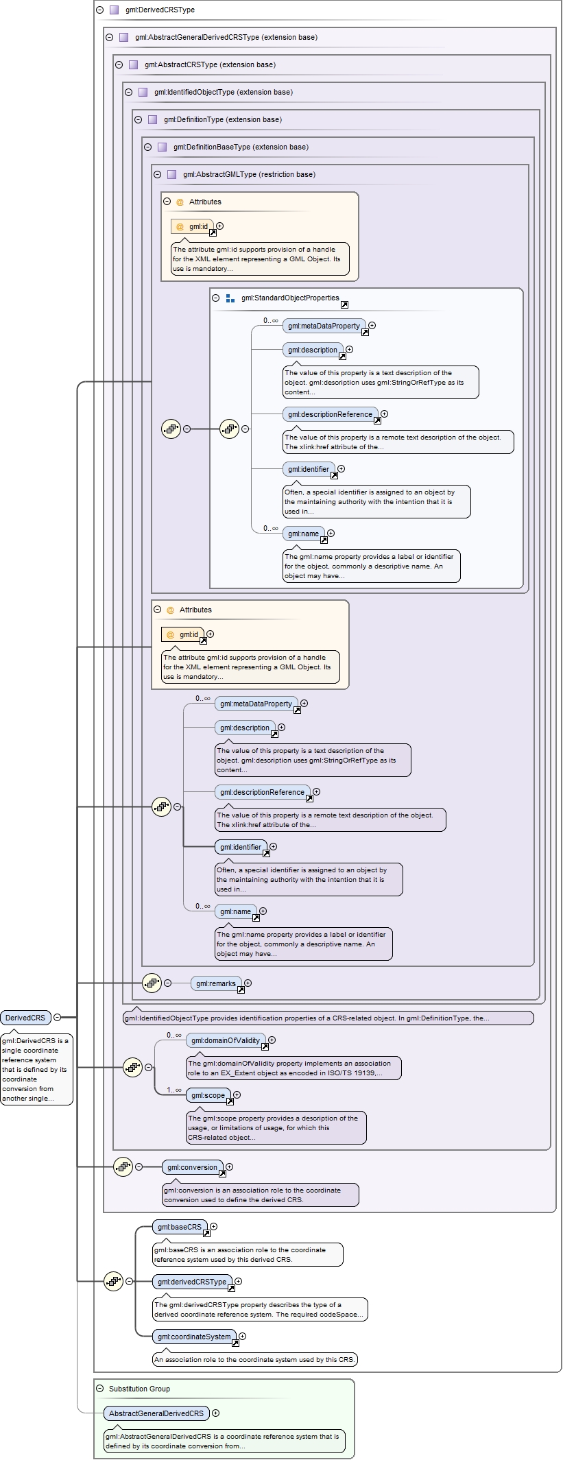
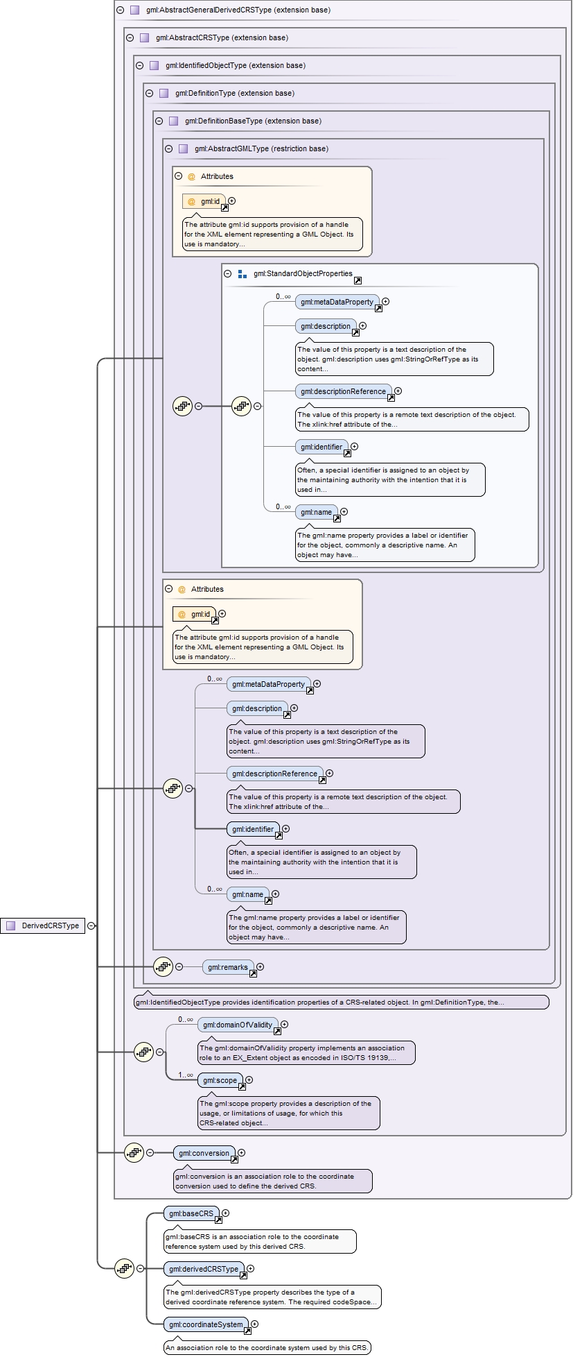
Element gml:DerivedCRS
Namespace
http://www.opengis.net/gml/3.2
Annotations
gml:DerivedCRS is a single coordinate reference system that is defined by its coordinate conversion from another single coordinate reference system known as the base CRS. The base CRS can be a projected coordinate reference system, if this DerivedCRS is used for a georectified grid coverage as described in ISO 19123, Clause 8.
The attribute gml:id supports provision of a handle for the XML element representing a GML Object. Its use is mandatory for all GML objects. It is of XML type ID, so is constrained to be unique in the XML document within which it occurs.
Source
<element name="DerivedCRS" type="gml:DerivedCRSType" substitutionGroup="gml:AbstractGeneralDerivedCRS"><annotation><documentation>gml:DerivedCRS is a single coordinate reference system that is defined by its coordinate conversion from another single coordinate reference system known as the base CRS. The base CRS can be a projected coordinate reference system, if this DerivedCRS is used for a georectified grid coverage as described in ISO 19123, Clause 8.</documentation></annotation></element>
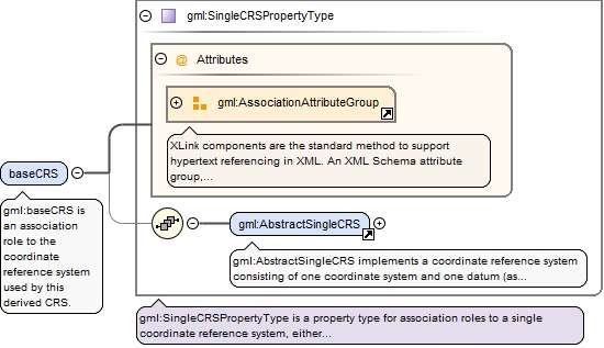
Element gml:baseCRS
Namespace
http://www.opengis.net/gml/3.2
Annotations
gml:baseCRS is an association role to the coordinate reference system used by this derived CRS.
<element name="baseCRS" type="gml:SingleCRSPropertyType"><annotation><documentation>gml:baseCRS is an association role to the coordinate reference system used by this derived CRS.</documentation></annotation></element>
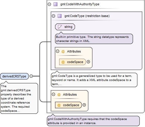
Element gml:derivedCRSType
Namespace
http://www.opengis.net/gml/3.2
Annotations
The gml:derivedCRSType property describes the type of a derived coordinate reference system. The required codeSpace attribute shall reference a source of information specifying the values and meanings of all the allowed string values for this property.
<element name="derivedCRSType" type="gml:CodeWithAuthorityType"><annotation><documentation>The gml:derivedCRSType property describes the type of a derived coordinate reference system. The required codeSpace attribute shall reference a source of information specifying the values and meanings of all the allowed string values for this property.</documentation></annotation></element>
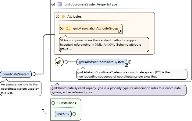
Element gml:coordinateSystem
Namespace
http://www.opengis.net/gml/3.2
Annotations
An association role to the coordinate system used by this CRS.
<element name="coordinateSystem" type="gml:CoordinateSystemPropertyType"><annotation><documentation>An association role to the coordinate system used by this CRS.</documentation></annotation></element>
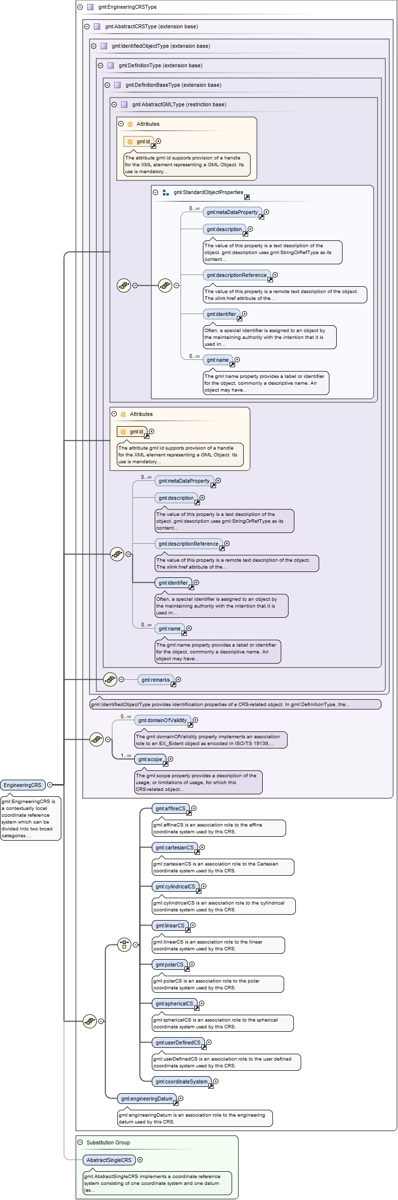
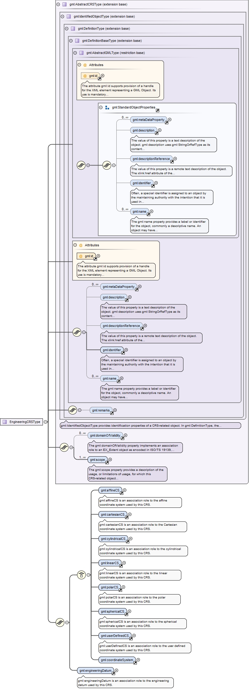
Element gml:EngineeringCRS
Namespace
http://www.opengis.net/gml/3.2
Annotations
gml:EngineeringCRS is a contextually local coordinate reference system which can be divided into two broad categories:- earth-fixed systems applied to engineering activities on or near the surface of the earth;- CRSs on moving platforms such as road vehicles, vessels, aircraft, or spacecraft, see ISO 19111 8.3.
The attribute gml:id supports provision of a handle for the XML element representing a GML Object. Its use is mandatory for all GML objects. It is of XML type ID, so is constrained to be unique in the XML document within which it occurs.
Source
<element name="EngineeringCRS" type="gml:EngineeringCRSType" substitutionGroup="gml:AbstractSingleCRS"><annotation><documentation>gml:EngineeringCRS is a contextually local coordinate reference system which can be divided into two broad categories: - earth-fixed systems applied to engineering activities on or near the surface of the earth; - CRSs on moving platforms such as road vehicles, vessels, aircraft, or spacecraft, see ISO 19111 8.3.</documentation></annotation></element>
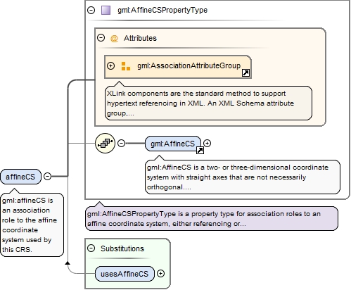
Element gml:affineCS
Namespace
http://www.opengis.net/gml/3.2
Annotations
gml:affineCS is an association role to the affine coordinate system used by this CRS.
<element name="affineCS" type="gml:AffineCSPropertyType"><annotation><documentation>gml:affineCS is an association role to the affine coordinate system used by this CRS.</documentation></annotation></element>
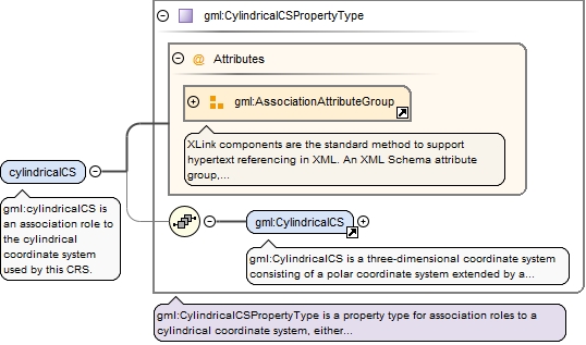
Element gml:cylindricalCS
Namespace
http://www.opengis.net/gml/3.2
Annotations
gml:cylindricalCS is an association role to the cylindrical coordinate system used by this CRS.
<element name="cylindricalCS" type="gml:CylindricalCSPropertyType"><annotation><documentation>gml:cylindricalCS is an association role to the cylindrical coordinate system used by this CRS.</documentation></annotation></element>
Element gml:linearCS
Namespace
http://www.opengis.net/gml/3.2
Annotations
gml:linearCS is an association role to the linear coordinate system used by this CRS.
<element name="linearCS" type="gml:LinearCSPropertyType"><annotation><documentation>gml:linearCS is an association role to the linear coordinate system used by this CRS.</documentation></annotation></element>
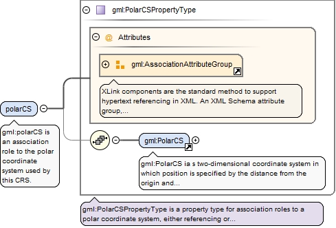
Element gml:polarCS
Namespace
http://www.opengis.net/gml/3.2
Annotations
gml:polarCS is an association role to the polar coordinate system used by this CRS.
<element name="polarCS" type="gml:PolarCSPropertyType"><annotation><documentation>gml:polarCS is an association role to the polar coordinate system used by this CRS.</documentation></annotation></element>
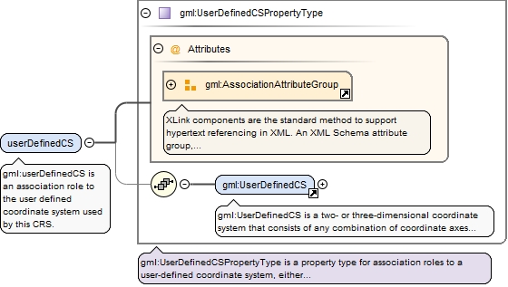
Element gml:userDefinedCS
Namespace
http://www.opengis.net/gml/3.2
Annotations
gml:userDefinedCS is an association role to the user defined coordinate system used by this CRS.
<element name="userDefinedCS" type="gml:UserDefinedCSPropertyType"><annotation><documentation>gml:userDefinedCS is an association role to the user defined coordinate system used by this CRS.</documentation></annotation></element>
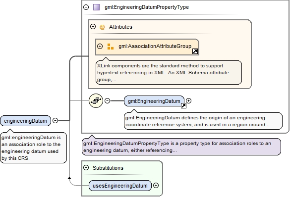
Element gml:engineeringDatum
Namespace
http://www.opengis.net/gml/3.2
Annotations
gml:engineeringDatum is an association role to the engineering datum used by this CRS.
<element name="engineeringDatum" type="gml:EngineeringDatumPropertyType"><annotation><documentation>gml:engineeringDatum is an association role to the engineering datum used by this CRS.</documentation></annotation></element>
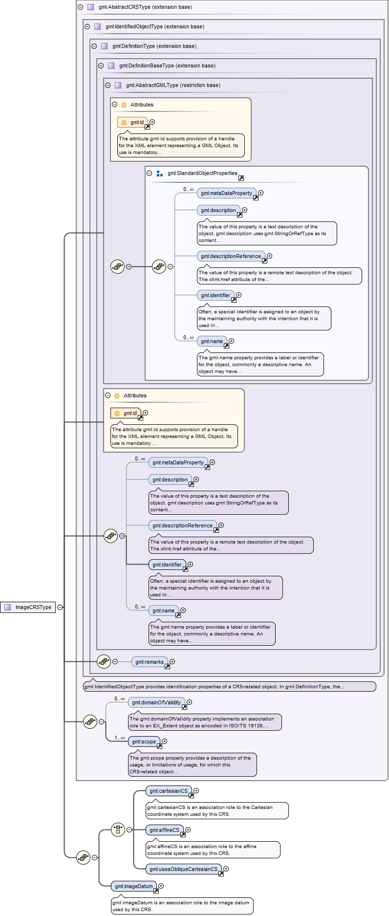
Element gml:ImageCRS
Namespace
http://www.opengis.net/gml/3.2
Annotations
gml:ImageCRS is an engineering coordinate reference system applied to locations in images. Image coordinate reference systems are treated as a separate sub-type because the definition of the associated image datum contains two attributes not relevant to other engineering datums.
The attribute gml:id supports provision of a handle for the XML element representing a GML Object. Its use is mandatory for all GML objects. It is of XML type ID, so is constrained to be unique in the XML document within which it occurs.
Source
<element name="ImageCRS" type="gml:ImageCRSType" substitutionGroup="gml:AbstractSingleCRS"><annotation><documentation>gml:ImageCRS is an engineering coordinate reference system applied to locations in images. Image coordinate reference systems are treated as a separate sub-type because the definition of the associated image datum contains two attributes not relevant to other engineering datums.</documentation></annotation></element>
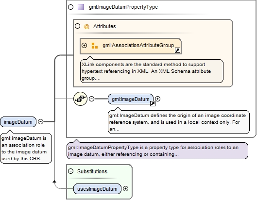
Element gml:imageDatum
Namespace
http://www.opengis.net/gml/3.2
Annotations
gml:imageDatum is an association role to the image datum used by this CRS.
<element name="imageDatum" type="gml:ImageDatumPropertyType"><annotation><documentation>gml:imageDatum is an association role to the image datum used by this CRS.</documentation></annotation></element>
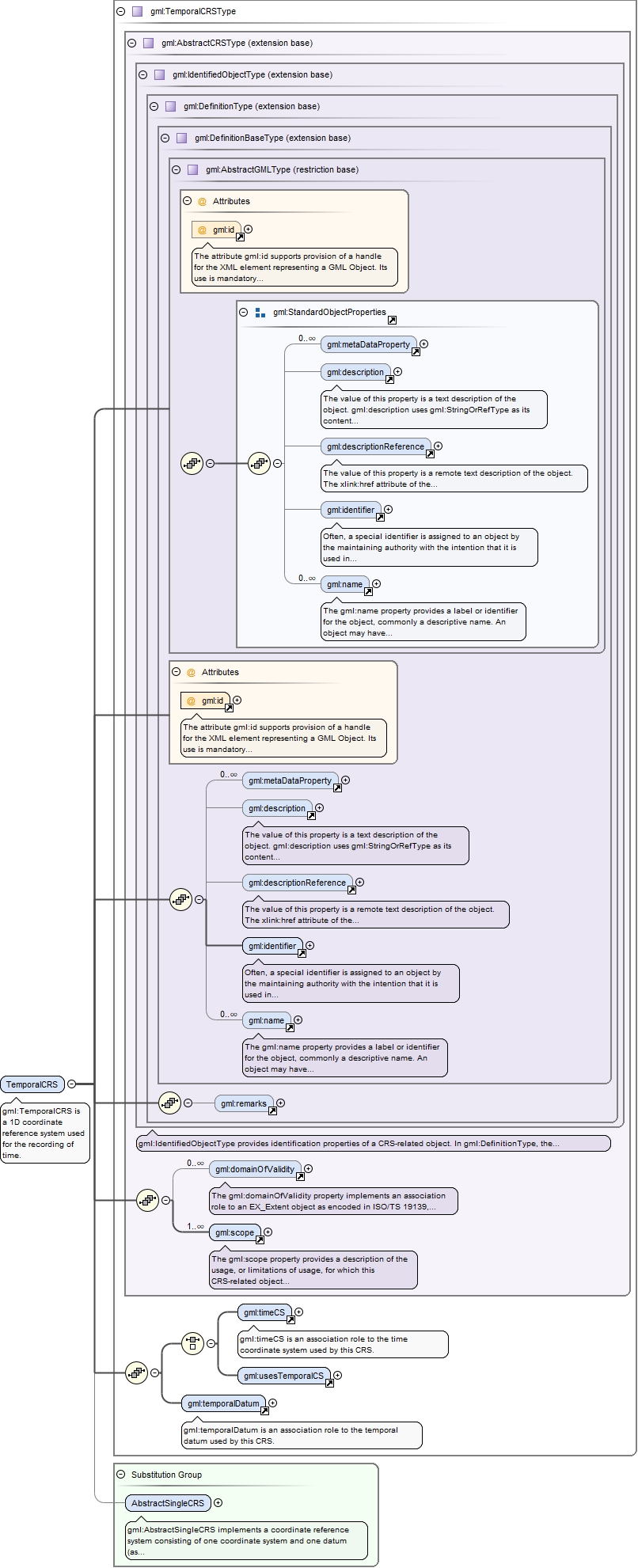
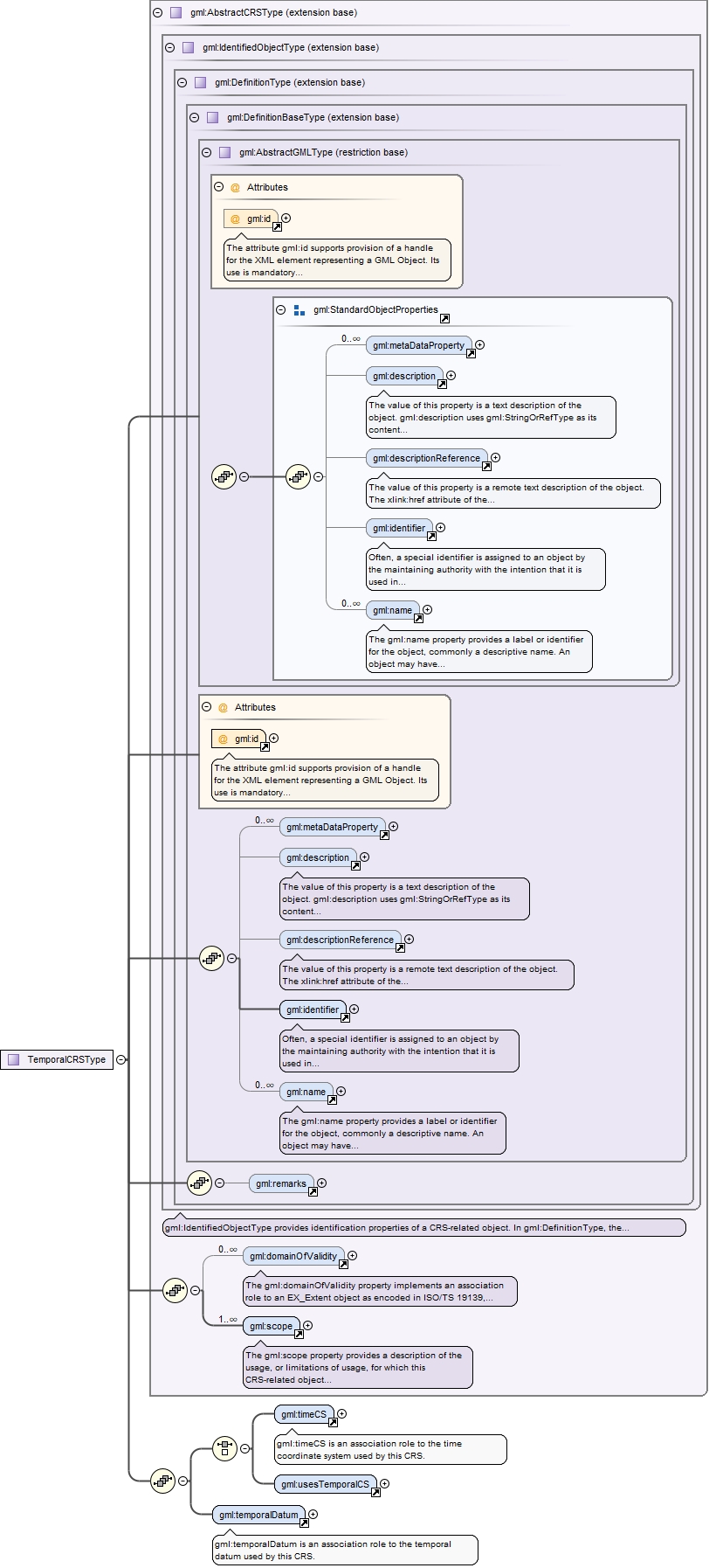
Element gml:TemporalCRS
Namespace
http://www.opengis.net/gml/3.2
Annotations
gml:TemporalCRS is a 1D coordinate reference system used for the recording of time.
The attribute gml:id supports provision of a handle for the XML element representing a GML Object. Its use is mandatory for all GML objects. It is of XML type ID, so is constrained to be unique in the XML document within which it occurs.
Source
<element name="TemporalCRS" type="gml:TemporalCRSType" substitutionGroup="gml:AbstractSingleCRS"><annotation><documentation>gml:TemporalCRS is a 1D coordinate reference system used for the recording of time.</documentation></annotation></element>
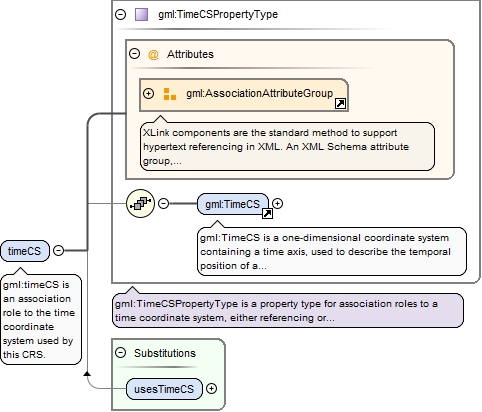
Element gml:timeCS
Namespace
http://www.opengis.net/gml/3.2
Annotations
gml:timeCS is an association role to the time coordinate system used by this CRS.
<element name="timeCS" type="gml:TimeCSPropertyType"><annotation><documentation>gml:timeCS is an association role to the time coordinate system used by this CRS.</documentation></annotation></element>
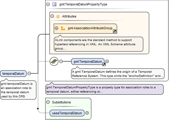
Element gml:temporalDatum
Namespace
http://www.opengis.net/gml/3.2
Annotations
gml:temporalDatum is an association role to the temporal datum used by this CRS.
<element name="temporalDatum" type="gml:TemporalDatumPropertyType"><annotation><documentation>gml:temporalDatum is an association role to the temporal datum used by this CRS.</documentation></annotation></element>
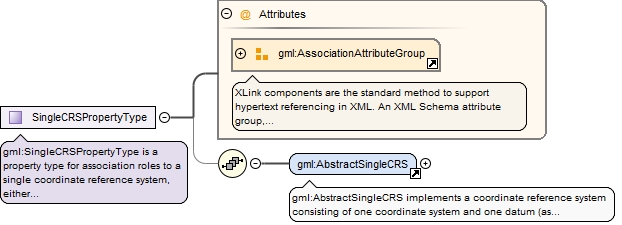
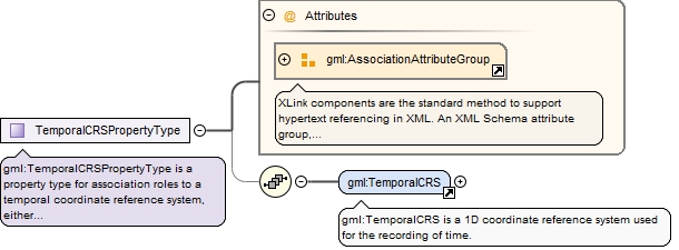
Complex Type gml:SingleCRSPropertyType
Namespace
http://www.opengis.net/gml/3.2
Annotations
gml:SingleCRSPropertyType is a property type for association roles to a single coordinate reference system, either referencing or containing the definition of that coordinate reference system.
<complexType name="SingleCRSPropertyType"><annotation><documentation>gml:SingleCRSPropertyType is a property type for association roles to a single coordinate reference system, either referencing or containing the definition of that coordinate reference system.</documentation></annotation><sequence minOccurs="0"><element ref="gml:AbstractSingleCRS"/></sequence><attributeGroup ref="gml:AssociationAttributeGroup"/></complexType>
The attribute gml:id supports provision of a handle for the XML element representing a GML Object. Its use is mandatory for all GML objects. It is of XML type ID, so is constrained to be unique in the XML document within which it occurs.
The attribute gml:id supports provision of a handle for the XML element representing a GML Object. Its use is mandatory for all GML objects. It is of XML type ID, so is constrained to be unique in the XML document within which it occurs.
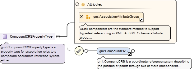
gml:CompoundCRSPropertyType is a property type for association roles to a compound coordinate reference system, either referencing or containing the definition of that reference system.
<complexType name="CompoundCRSPropertyType"><annotation><documentation>gml:CompoundCRSPropertyType is a property type for association roles to a compound coordinate reference system, either referencing or containing the definition of that reference system.</documentation></annotation><sequence minOccurs="0"><element ref="gml:CompoundCRS"/></sequence><attributeGroup ref="gml:AssociationAttributeGroup"/></complexType>
Complex Type gml:GeodeticCRSType
Namespace
http://www.opengis.net/gml/3.2
Annotations
gml:GeodeticCRS is a coordinate reference system based on a geodetic datum.
The attribute gml:id supports provision of a handle for the XML element representing a GML Object. Its use is mandatory for all GML objects. It is of XML type ID, so is constrained to be unique in the XML document within which it occurs.
Source
<complexType name="GeodeticCRSType"><annotation><documentation>gml:GeodeticCRS is a coordinate reference system based on a geodetic datum.</documentation></annotation><complexContent><extension base="gml:AbstractCRSType"><sequence><choice><element ref="gml:ellipsoidalCS"/><element ref="gml:cartesianCS"/><element ref="gml:sphericalCS"/></choice><element ref="gml:geodeticDatum"/></sequence></extension></complexContent></complexType>
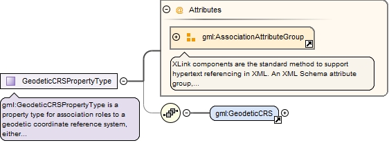
Complex Type gml:GeodeticCRSPropertyType
Namespace
http://www.opengis.net/gml/3.2
Annotations
gml:GeodeticCRSPropertyType is a property type for association roles to a geodetic coordinate reference system, either referencing or containing the definition of that reference system.
<complexType name="GeodeticCRSPropertyType"><annotation><documentation>gml:GeodeticCRSPropertyType is a property type for association roles to a geodetic coordinate reference system, either referencing or containing the definition of that reference system.</documentation></annotation><sequence minOccurs="0"><element ref="gml:GeodeticCRS"/></sequence><attributeGroup ref="gml:AssociationAttributeGroup"/></complexType>
The attribute gml:id supports provision of a handle for the XML element representing a GML Object. Its use is mandatory for all GML objects. It is of XML type ID, so is constrained to be unique in the XML document within which it occurs.
gml:VerticalCRSPropertyType is a property type for association roles to a vertical coordinate reference system, either referencing or containing the definition of that reference system.
<complexType name="VerticalCRSPropertyType"><annotation><documentation>gml:VerticalCRSPropertyType is a property type for association roles to a vertical coordinate reference system, either referencing or containing the definition of that reference system.</documentation></annotation><sequence minOccurs="0"><element ref="gml:VerticalCRS"/></sequence><attributeGroup ref="gml:AssociationAttributeGroup"/></complexType>
The attribute gml:id supports provision of a handle for the XML element representing a GML Object. Its use is mandatory for all GML objects. It is of XML type ID, so is constrained to be unique in the XML document within which it occurs.
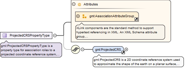
gml:ProjectedCRSPropertyType is a property type for association roles to a projected coordinate reference system, either referencing or containing the definition of that reference system.
<complexType name="ProjectedCRSPropertyType"><annotation><documentation>gml:ProjectedCRSPropertyType is a property type for association roles to a projected coordinate reference system, either referencing or containing the definition of that reference system.</documentation></annotation><sequence minOccurs="0"><element ref="gml:ProjectedCRS"/></sequence><attributeGroup ref="gml:AssociationAttributeGroup"/></complexType>
The attribute gml:id supports provision of a handle for the XML element representing a GML Object. Its use is mandatory for all GML objects. It is of XML type ID, so is constrained to be unique in the XML document within which it occurs.
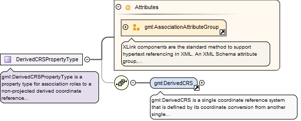
gml:DerivedCRSPropertyType is a property type for association roles to a non-projected derived coordinate reference system, either referencing or containing the definition of that reference system.
<complexType name="DerivedCRSPropertyType"><annotation><documentation>gml:DerivedCRSPropertyType is a property type for association roles to a non-projected derived coordinate reference system, either referencing or containing the definition of that reference system.</documentation></annotation><sequence minOccurs="0"><element ref="gml:DerivedCRS"/></sequence><attributeGroup ref="gml:AssociationAttributeGroup"/></complexType>
The attribute gml:id supports provision of a handle for the XML element representing a GML Object. Its use is mandatory for all GML objects. It is of XML type ID, so is constrained to be unique in the XML document within which it occurs.
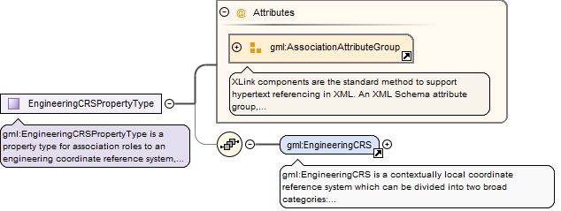
gml:EngineeringCRSPropertyType is a property type for association roles to an engineering coordinate reference system, either referencing or containing the definition of that reference system.
<complexType name="EngineeringCRSPropertyType"><annotation><documentation>gml:EngineeringCRSPropertyType is a property type for association roles to an engineering coordinate reference system, either referencing or containing the definition of that reference system.</documentation></annotation><sequence minOccurs="0"><element ref="gml:EngineeringCRS"/></sequence><attributeGroup ref="gml:AssociationAttributeGroup"/></complexType>
The attribute gml:id supports provision of a handle for the XML element representing a GML Object. Its use is mandatory for all GML objects. It is of XML type ID, so is constrained to be unique in the XML document within which it occurs.
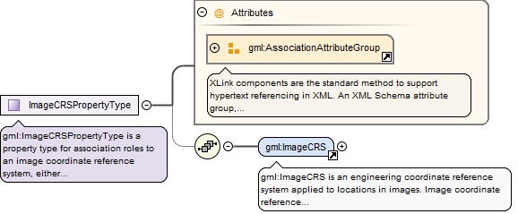
gml:ImageCRSPropertyType is a property type for association roles to an image coordinate reference system, either referencing or containing the definition of that reference system.
<complexType name="ImageCRSPropertyType"><annotation><documentation>gml:ImageCRSPropertyType is a property type for association roles to an image coordinate reference system, either referencing or containing the definition of that reference system.</documentation></annotation><sequence minOccurs="0"><element ref="gml:ImageCRS"/></sequence><attributeGroup ref="gml:AssociationAttributeGroup"/></complexType>
The attribute gml:id supports provision of a handle for the XML element representing a GML Object. Its use is mandatory for all GML objects. It is of XML type ID, so is constrained to be unique in the XML document within which it occurs.
gml:TemporalCRSPropertyType is a property type for association roles to a temporal coordinate reference system, either referencing or containing the definition of that reference system.
<complexType name="TemporalCRSPropertyType"><annotation><documentation>gml:TemporalCRSPropertyType is a property type for association roles to a temporal coordinate reference system, either referencing or containing the definition of that reference system.</documentation></annotation><sequence minOccurs="0"><element ref="gml:TemporalCRS"/></sequence><attributeGroup ref="gml:AssociationAttributeGroup"/></complexType>