| diagram | 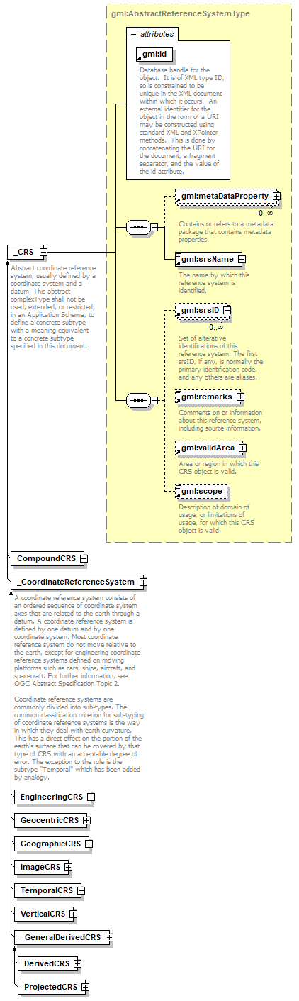 |
||||||||||||||
| namespace | http://www.opengis.net/gml | ||||||||||||||
| type | gml:AbstractReferenceSystemType | ||||||||||||||
| properties |
|
||||||||||||||
| children | gml:metaDataProperty gml:srsName gml:srsID gml:remarks gml:validArea gml:scope | ||||||||||||||
| used by |
|
||||||||||||||
| attributes |
|
||||||||||||||
| annotation |
|
||||||||||||||
| source | <xs:element name="_CRS" type="gml:AbstractReferenceSystemType" abstract="true" substitutionGroup="gml:_ReferenceSystem"> <xs:annotation> <xs:documentation>Abstract coordinate reference system, usually defined by a coordinate system and a datum. This abstract complexType shall not be used, extended, or restricted, in an Application Schema, to define a concrete subtype with a meaning equivalent to a concrete subtype specified in this document.</xs:documentation> </xs:annotation> </xs:element> |
XML Schema documentation generated by XMLSpy Schema Editor http://www.altova.com/xmlspy