| Namespace | http://www.isotc211.org/2005/gss | ||||||||||||||||||||||||||||||||||||||||||||||||||
|
Diagram
|
 |
||||||||||||||||||||||||||||||||||||||||||||||||||
|
Used by
|
|||||||||||||||||||||||||||||||||||||||||||||||||||
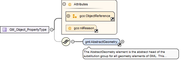
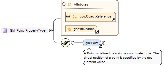
| Model | |||||||||||||||||||||||||||||||||||||||||||||||||||
| Children | gml:Point | ||||||||||||||||||||||||||||||||||||||||||||||||||
|
Attributes
|
|
||||||||||||||||||||||||||||||||||||||||||||||||||
|
Source
|
|